Hydrologic Geological Detecting Vehicle
The hydrologic geological detecting vehicle integrates instruments of echo sounder, hydrometer propeller, ranging laser, GPS receive unit and anemometer into one system through digital interface on the base of computer. The vehicle employs fashion amphibious can to increase the flexibility and mobility.
The hydrologic geological detecting vehicle adopts computer data control and processing technology, which can automatically complete the collection, analysis, and proceed of data. In the process of working, the system provides direction indication, full-screen monitoring, data curve display in real time. So it increases the level of automation of detection of river engineering and processing efficiency.
The hydrologic geological detecting vehicle is widely used for searching hydrologic and geological data as the reference for policy-makers of relative departments.
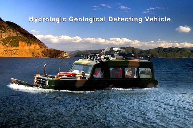
The hydrologic detecting vehicle's sensors include the river bed cross section mapping system and velocity of flow measurement system; simultaneously integrate the wind speed and direction measuring, video gathering, laser ranging, GPS localization, guidance and so on. The system is controlled by computer software, realized the hydrologic detecting work’s automation and digitization.
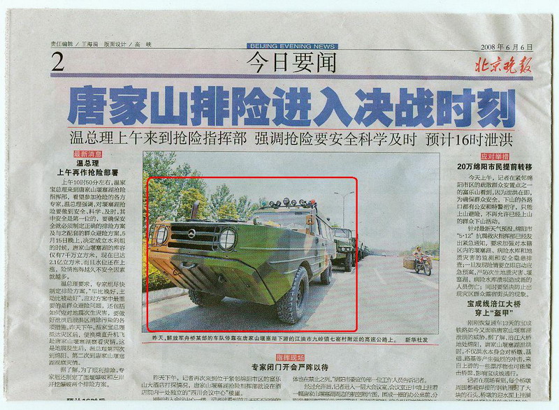
In the CHina "5.12"earthquake, the Hydrologic Geological Detecting VeHIcle together with other rescue equipments played a great role in searcHIng the crashed helicopter.
Time:2008/7/10 Number of visits:313 |